Translated by Google Translator.
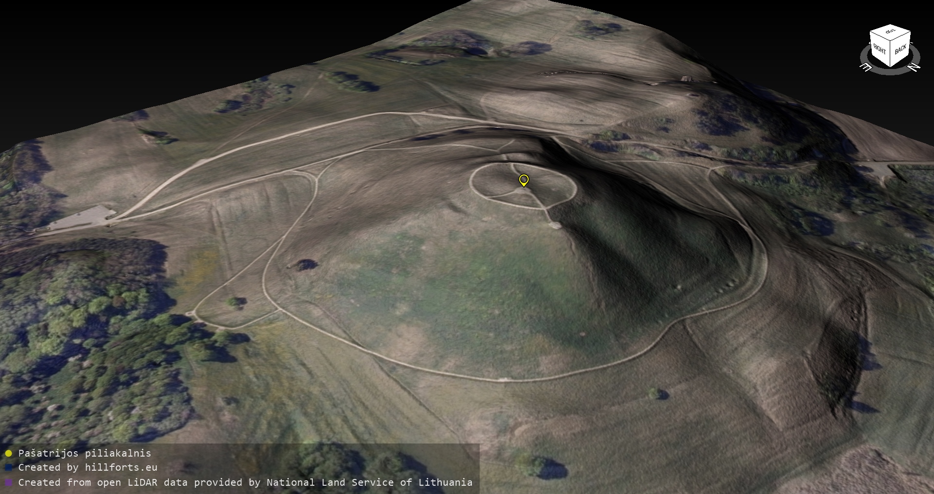
Received shipment from Lithuania – HDD with 4Tb Lidar and Ortofoto raw data from the Lithuanian Land Service. Ahead is an ultramarathon of making 3D models and digital re-measurement of the Iron Age hillforts of the territory of Lithuania, taking into account that there are 2x more such hillforts in Lithuania than in the territory of Latvia. Thanks to Renata Drukteinytė for technical support.
All 3D models, their images, measurement results, etc. type of additional information (but not raw data from Lithuania) will be freely available for use in the open data repository https://opendata.latvijas-pilskalni.lv
At the same time, intensive work is being done on the development of the new version of the hillforts/ancient sites website.
We remind you that currently collected information is available on the websites www.latvijas-pilskalni.lv, hillforts.eu and www.senvietas.lv. The open data repository is available on the website opendata.latvijas-pilskalni.lv. An interactive map of ancient sites has been created, where you will find information related to ancient sites also in our neighboring countries.
Open data can be used freely and free of charge, as evidenced by an electronically signed document in the open data repository.
The open data citizen science project “Latvijas pilskalni” is a private initiative and works thanks to donations. The project won the annual award of the Latvian Open Technologies Association (LATA) in the private sector.