Translated by Google Translator.
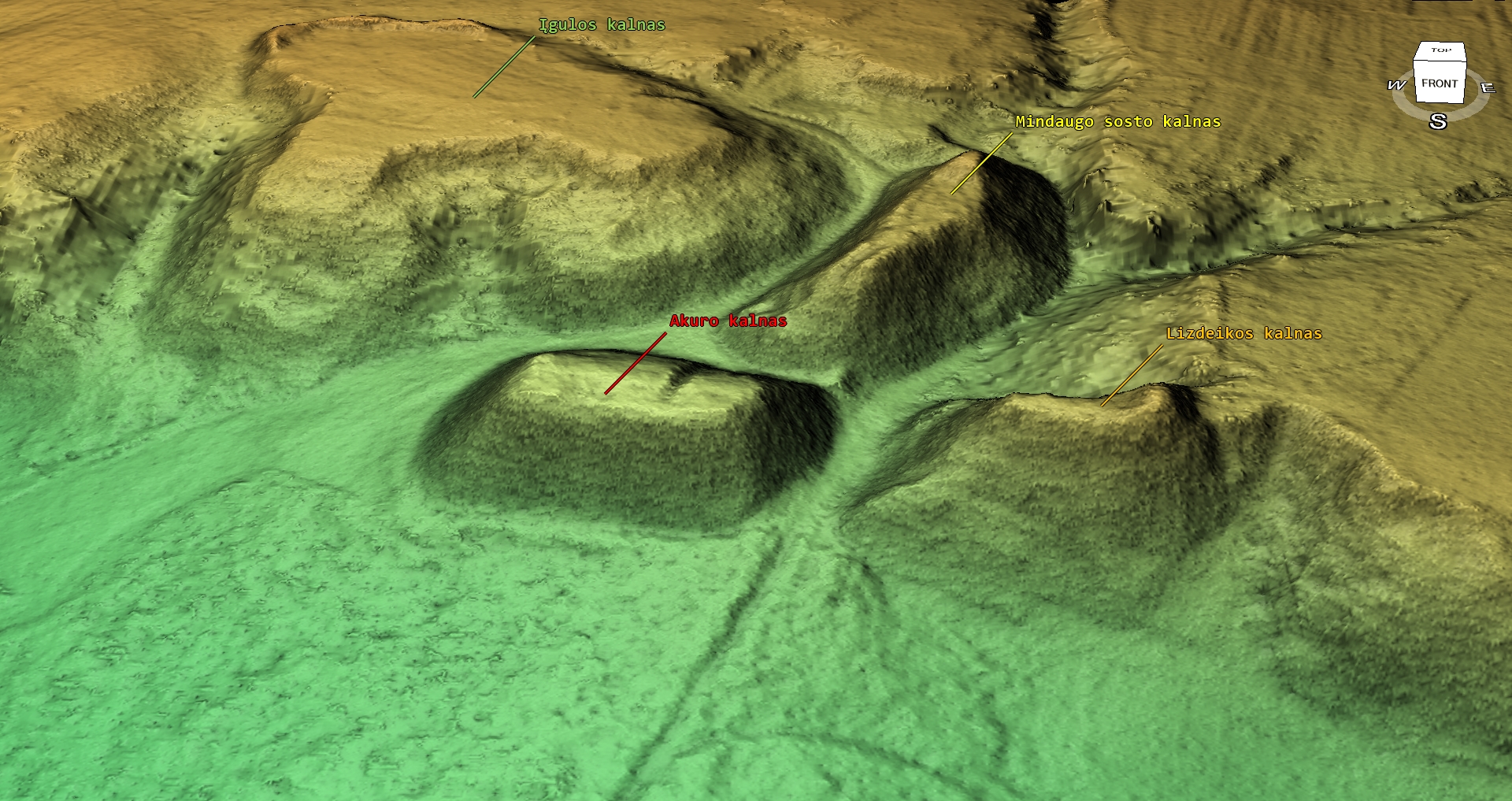
As part of the creation of a data repository of European Iron Age hillforts, a digital resurvey of Lithuanian hillforts has been started.
Resurveying takes place complexly with optimization of 3D models, similar to the process of resurveying Latvian and Estonian hillforts.
The measurement file is already available in the open data repository.
The currently collected information about Lithuania is available on the Google map. Information is being updated.
In parallel with these works, intensive work is being done on the development of the new version of the website. In the new version, data that are now available separately on www.latvijas-pilskalni.lv and www.senvietas.lv will be available together. Addresses for object descriptions will be the previous ones. The website will also be supplemented with the domain hilforts.eu, where information about other countries – Estonia, Lithuania, Poland, etc. will be available.
We remind you that currently collected information is available on the websites www.latvijas-pilskalni.lv, hillforts.eu and www.senvietas.lv. The open data repository is available on the website opendata.latvijas-pilskalni.lv. An interactive map of ancient sites has been created, where you will find information related to ancient sites also in our neighboring countries.
Open data can be used freely and free of charge, as evidenced by an electronically signed document in the open data repository.
The open data citizen science project “Latvijas pilskalni” is a private initiative and works thanks to donations. The project won the annual award of the Latvian Open Technologies Association (LATA) in the private sector.