Images of all hillforts in Lithuania are available on the service geo.hillforts.eu
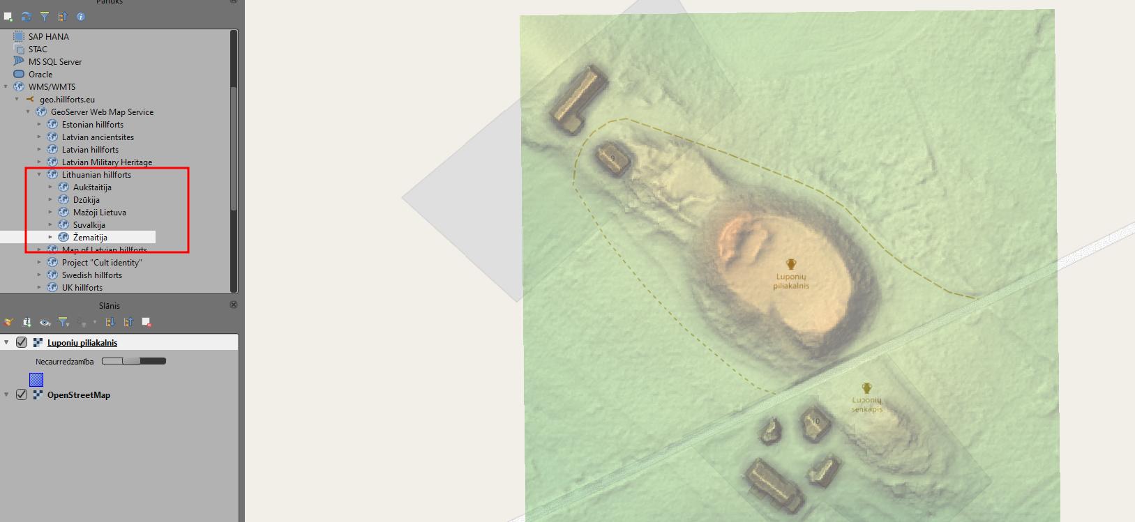
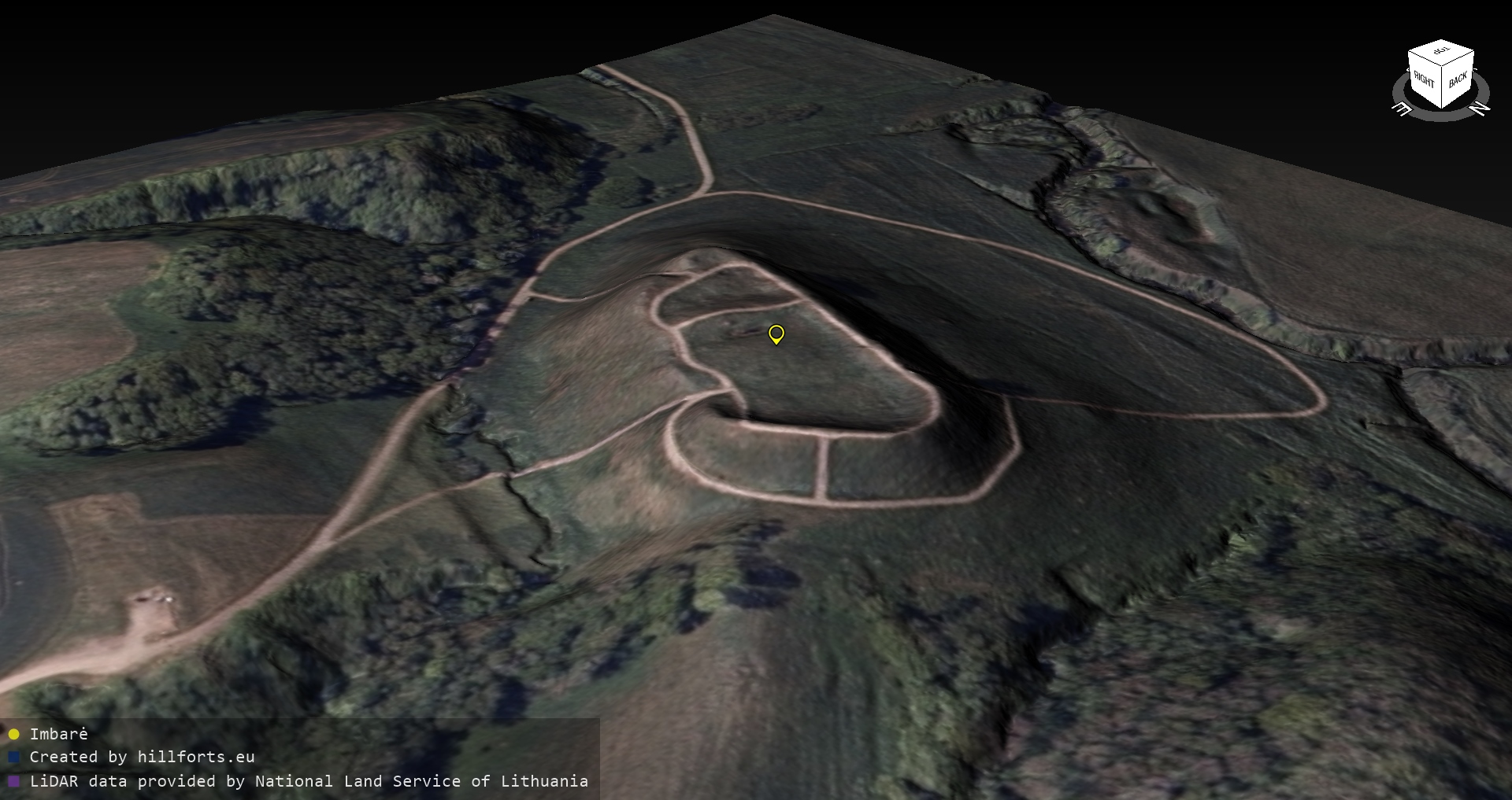
Georeferenced images of all hillforts in Lithuania are available on the free service geo.hillforts.eu

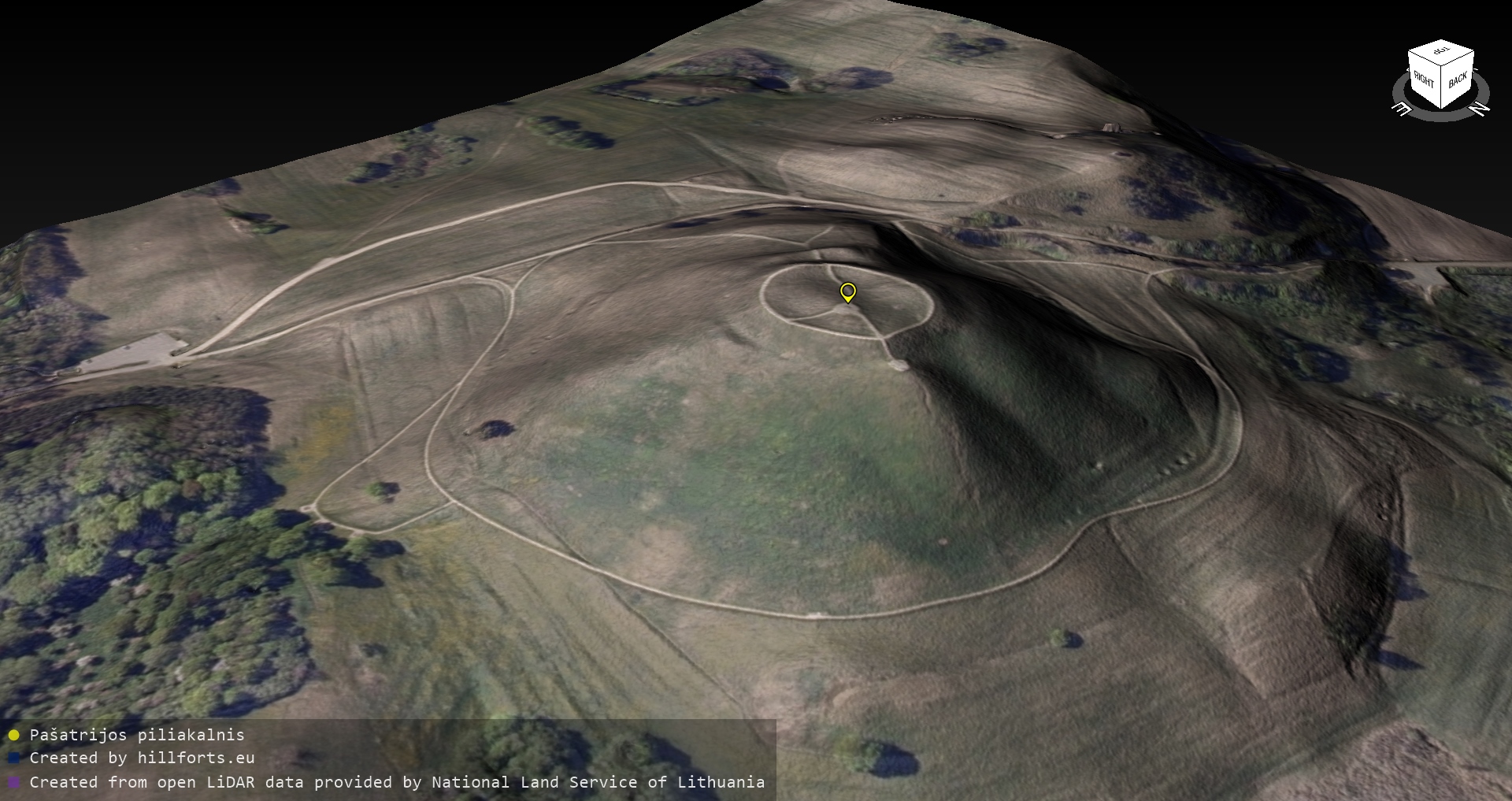
Georeferenced images of all hillforts in Lithuania are available on the free service geo.hillforts.eu
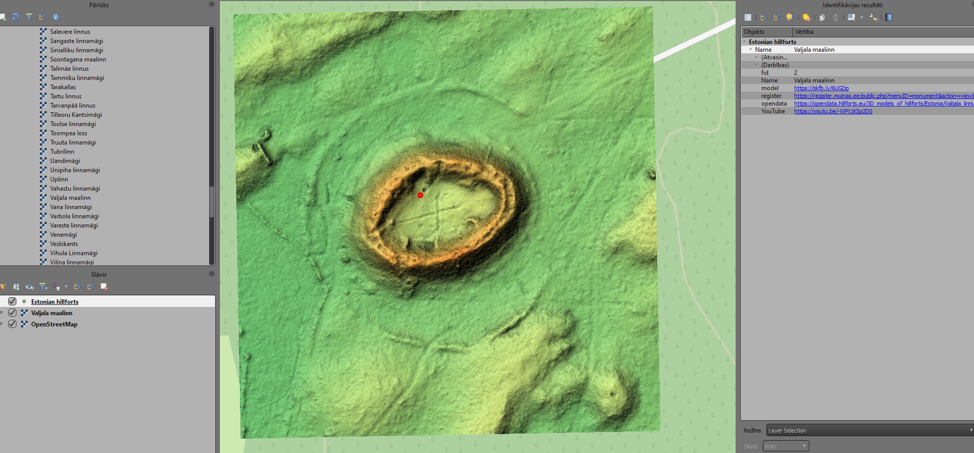
Georeferenced images of all hillforts in Estonia are available on the free service geo.hillforts.eu
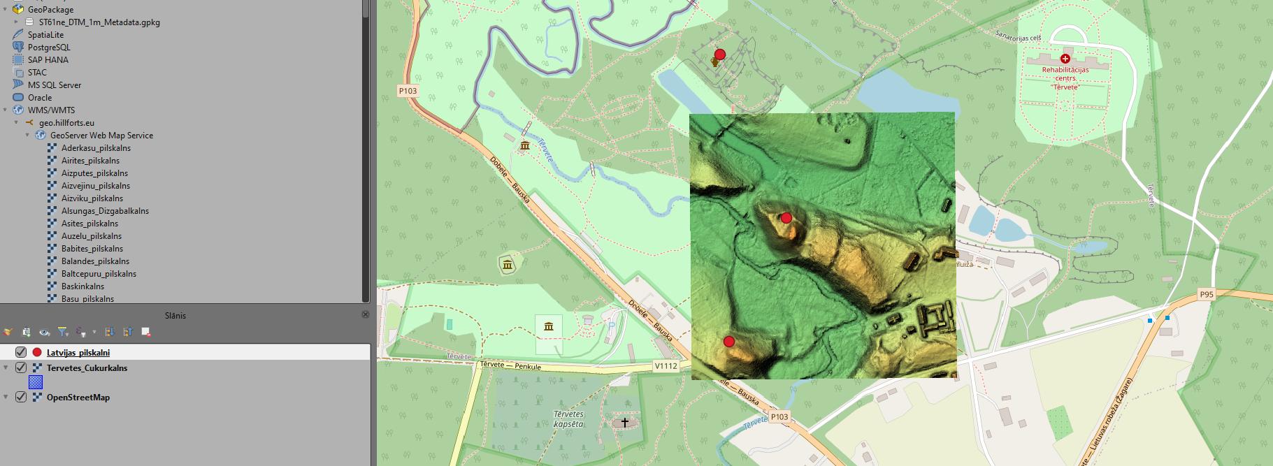
To ensure more convenient work with the data collected by this project, a geospatial data service has been created, available at geo.hillforts.eu.
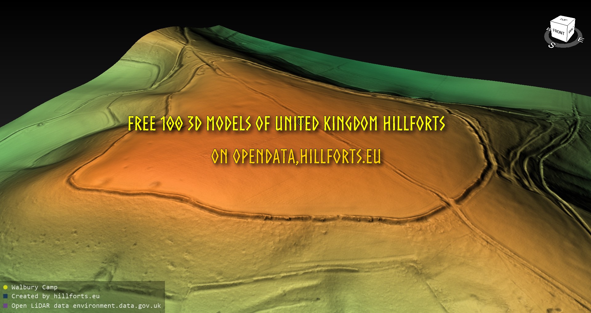
Explore on map: https://map.hillforts.eu Free open data: https://opendata.hillforts.eu/3D_models_of_hillforts/UK/

The non-profit amateur science project Hillforts.eu has already made available 300 3D models of hillforts in Poland available in the open data repository opendata.hillforts.eu.
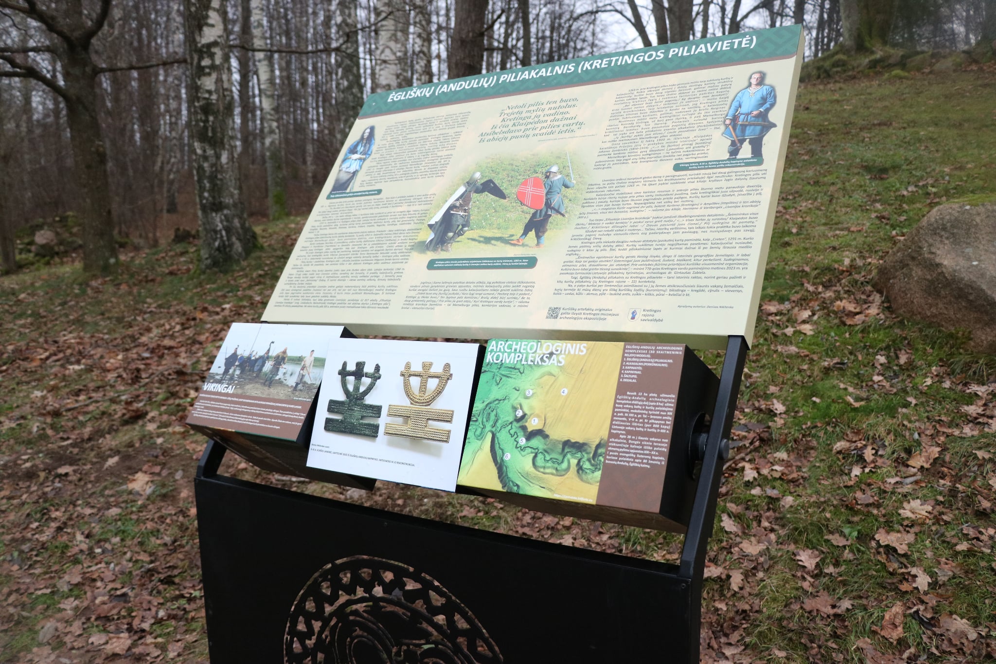
Information stand has been set up at the Ėgliškių (Andulių) hillfort
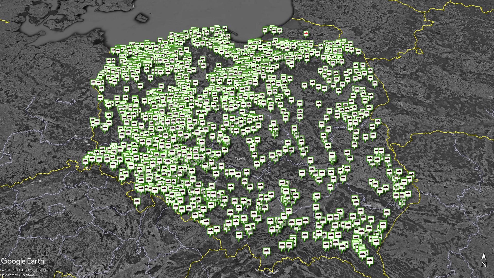
As part of the creation of a European database of hillforts, a map of hillforts in Poland has been created.
Translated by Google Translator. Measurements taken using the planlaufTerrain app. During the measurements, the length, width, height, length of the plain and width of the plain were recorded. Each measurement is recorded on the screen. More than 800 3D models created. The measurement data is currently available as a file in the open data […]
At the end of 2023, Gatis Kalniņš won the Juris Urtāns Dzirkaļi hillfort award announced by the Society of Latvian Archaeologists for his significant contribution to the recognition and popularization of Latvian hillforts. The creator, creator and maintainer of the well-known page latvijas-pilskalni.lv. In the interview, you can read how Gatis came to this idea, what works he has undertaken and what his future plans are.
Lithuanian LIDAR / orthophoto raw data received